
Want Your Farm Products to Penetrate the European Market & Become High-Value Products?
Don't let the hard work of local farmers be sold as ordinary commodities! EUDR (European Union Deforestation Regulation) enhances transparency, opens access to premium markets, and strengthens the position of Indonesian Coffee, Cocoa, Palm Oil, Rubber, and Spices internationally.
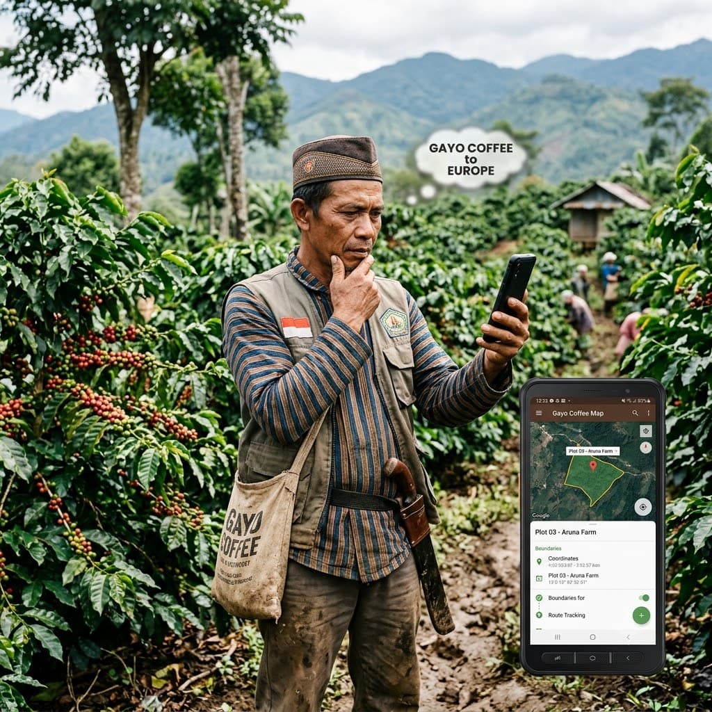
Without Digital Data & Transparency, Your Products Will Become Increasingly Hard to Compete in the Global Market!
Buyers in the European Union now require clear product origin information, including land location coordinates and proof that the commodities they purchase do not come from deforestation areas.
Your Products Rejected
Without land polygon mapping data (polygon mapping), your agricultural containers risk being rejected at European ports.
Losing Bargaining Power
Local farmers continue to lack bargaining power because they don't have independent digital certification recognized directly by international buyers.
Time Constraints
Exporters slow to digitize their data will lose competitiveness
Turn EUDR Rules Into Export Competitive Advantage With Agrantara!
We provide a complete digital ecosystem so local commodities meet sustainability standards and are ready for the European Union Due Diligence Statement (DDS) .
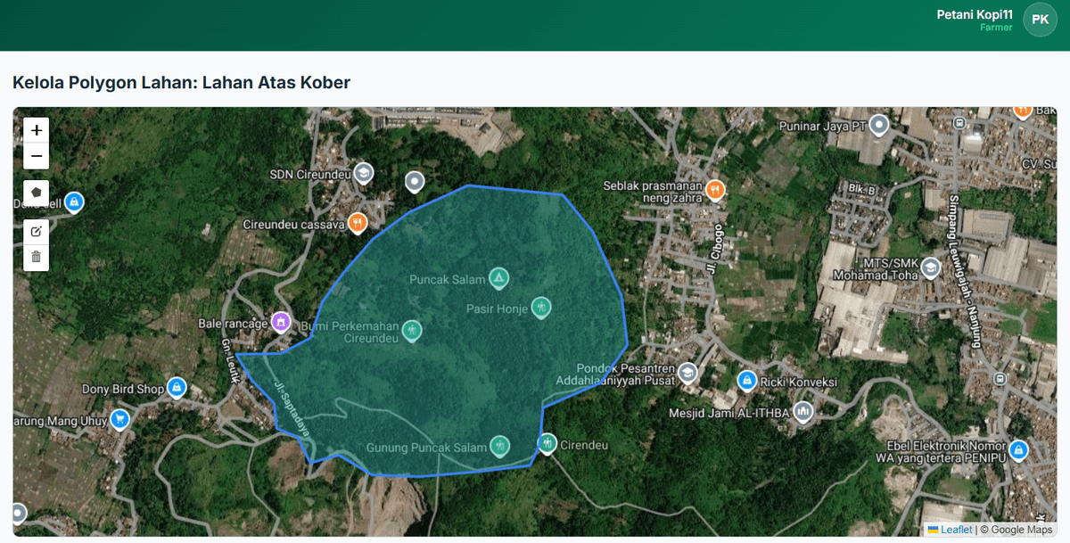
Precision Land Mapping & Geolocation (EUDR Ready)
Agrantara makes it easy for field teams to perform accurate polygon mapping of farmer land coordinates, even in offline conditions without cellular signal.
- ✓ Automatic forest area overlap verification
- ✓ One-click GeoJSON / SHP data export
- ✓ Satellite-based deforestation history validation
- ✓ Land legality data storage
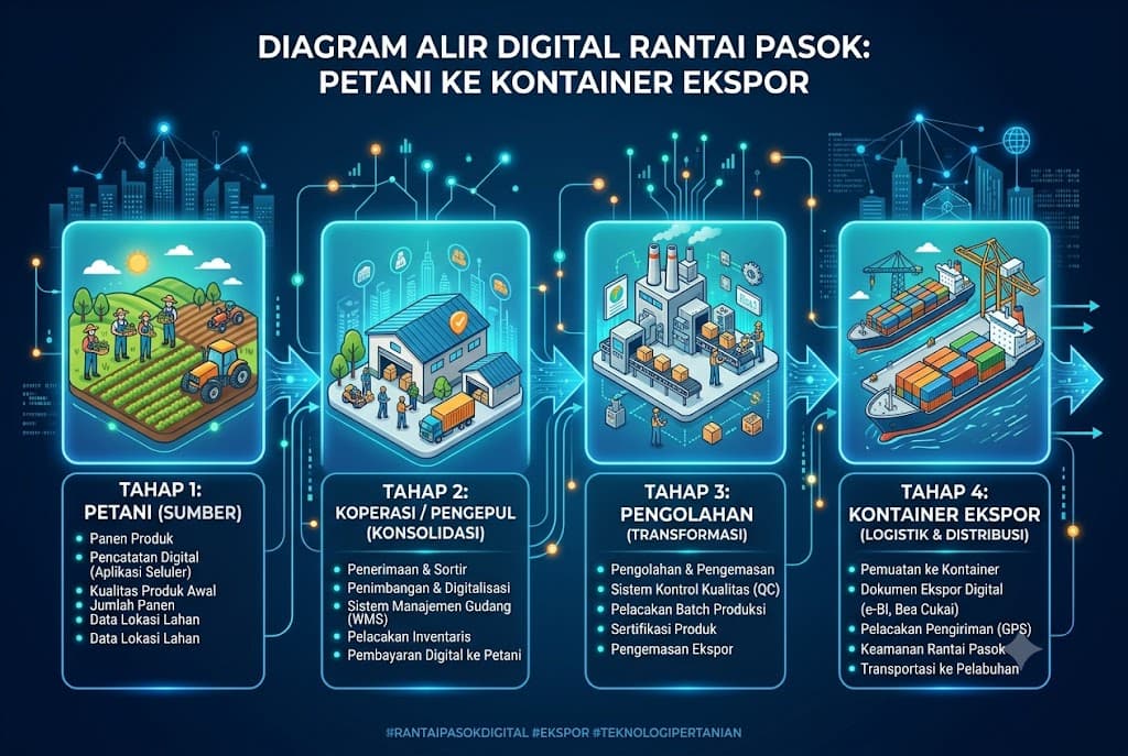
Digital Traceability (Supply Chain Tracking)
Track commodity journeys from farmer sacks to shipping containers. Total transparency that makes European buyers confident to pay premium prices.
- ✓ Print QR-Code for Harvest Lot / Batch
- ✓ Transparent & Accountable Transaction Records
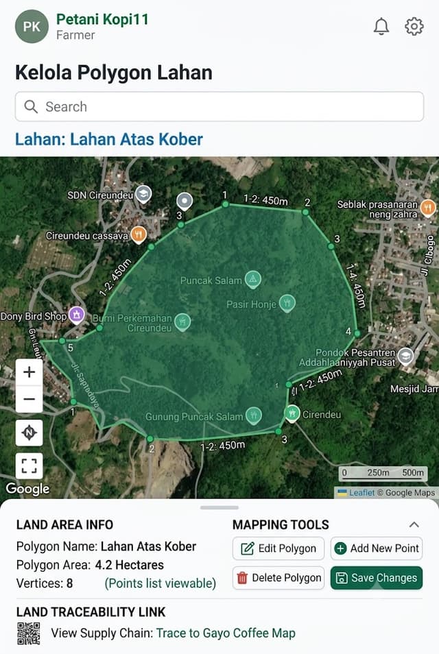
One App in Your Hand for Mapping Plantations Without Signal!
Specially designed for field facilitators and farmers in remote areas. You can still map plantation coordinates even without internet connection (Offline First).
Offline Mode
Save data on your phone, sync when signal is available.
High-Precision GPS
Polygon mapping accuracy meets EUDR standards.
Check Your Commodity EUDR Compliance Simulation
Answer 3 short questions below to see your export readiness score.